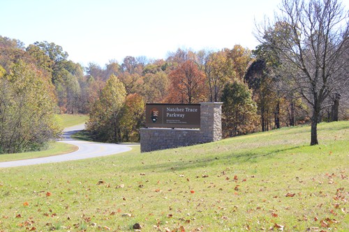
Day 2 of our journey, we headed to the Natchez Trace. The Trace is a 444 mile historical park that runs through 3 states, Tennessee, Alabama and ending in Mississippi. It is an old trail that the pioneers and the Indian's used for trading their goods. It would take a month to walk the trail from the beginning to end. There are 3 free trailer parks along the trail, as well as a couple of state parks. Of course, we chose to stay in the free parks.
We would highly recommend driving through Natchez Trace. It was a delightful and stress free way to put 444 miles behind us. (Well, except for the lack of internet and cell phone, that's pretty stressful)
There are many sights to see along the route. This is an old tobacco farm.

They even had tobacco drying in the barn.

This was our first night's parking spot. It was dark and quiet, we both slept like babies. The only light was from the stars and moon.

The next day we left early and saw 15 deer in the first hour of driving.


This Tom was guarding his flock from the opposite side of the road. When we drove up, he crossed the road in front of us to round up about 10 hens and hustle them into the bush.

This is the bridge over the Tennessee river There was a ferry here but that is long gone all they have now are the docks.

We saw at least half a dozen Cranes near the bridge.


There are a few of these mounds built by Indian tribes. They used them for burials, ceremonies, and temples.

Me on top

This one site had 8small mounds on it.

This was where a tornado hit in April 2011. There was devastation along road for miles. Hard to believe that it could rip the top
off those trees. This was part of a storm system that killed about 40 people, one of which was camping along the Natchez Trace.

This is our camp on the second night. It was so quiet until about 8:00 p.m., when 11 cars showed up and set up tents all around us. Each car had 2 or 3 kids. The kids were having a great time running back and forth between their campsites...right through the middle of ours.


This was pretty neat. These trails wore/sunk through bush from so much use. See Brenda on top the
hill just to show how deep they are. You can see the roots of the trees along the edge.


The Emerald Mound covers 8 acres, and is the second largest mount in the United States. Imagine how long it took to build it carrying dirt in baskets.

To give perspective of how big the mound is, Myrtle is about half as high as the first level.

The second level was 49 steps. That's Gerry standing on top of the first level.

The fog was so deep we couldn't see the Mississippi River as we crossed over it.

This is where we are tonight in Texas.We really don't fit in here. All the other campers are in newer, big rigs, some worth over half a million dollars. Myrtle is more dwarfed here than she was by the Emerald Mound!!! Ah, we don't mind, there are hot showers, wifi, cable television, a swimming pool and free breakfast. :)

We don't know exactly where we are going tomorrow. Perhaps only 1/2 hour down the road to the Gulf of Mexico, perhaps over to Galveston, perhaps we won't take the coast at all. For now, we are resting, and plan to have a relaxing morning.
Nice...I take it you're heading for Mexico? And apparently with a car this time!
ReplyDeleteYes we are heading to Mexico. We are going to see the east coast. We are taking our Smart car with it we should be able to see more. I hope we see you 2 again this year.
DeleteWe did the east coast in the fall/winter of 2008-2009. It will be interesting to see your take on that part of the country.
Delete